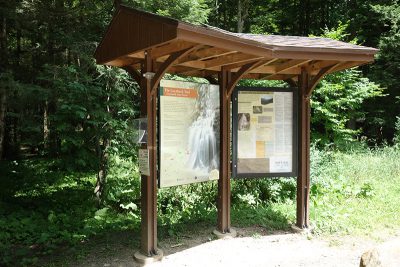
Today I went hiking on the Loyalsock Trail in Sullivan County on a quest to find the Angel Falls. This was a very arduous journey. Just finding the trail was pretty difficult. First you go North on Route 87. I’m sort of familiar with Route 87 because you get on it when leaving Walmart in Montoursville. You drive north on Route 87 until you get to Ogdonia Road on your right. Unfortunately there are no landmarks on the way that will alert you when you are getting close to that road. All I can say is that it is pass Barbours but before Hillsgrove. I did take a photo of exactly where you turn off Route 87 for future reference. My GPS was annoyingly useless.
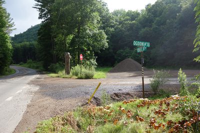
Ogdonia Road
Ogdonia Road is a gravel road. Along the way you will see a big sign reading “Entering Loyalsock State Forest”. Eventually you will see a sign for Brunnerdale Road pointing to the left. The Loyalsock Trail parking area is just across a bridge on Brunnerdale Road, not far from the crossroads. There is room for maybe five cars and I only saw one truck already there.
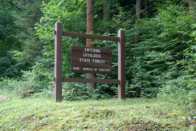
Entering Loyalsock State Forest
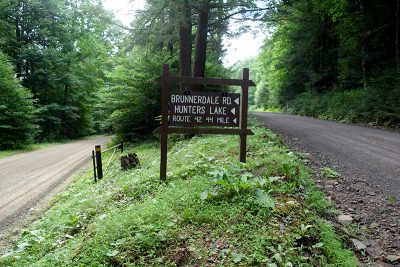
Brunnerdale Road
Loyalsock Trail Parking Area
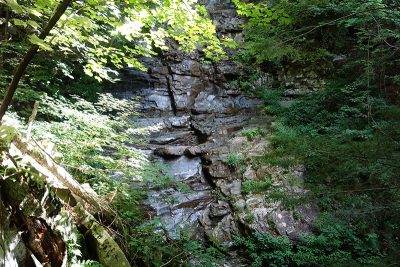
The entrance to a portion of Loyalsock Trail was pretty obvious. It follows the creek Brunnerdale Run. You then follow Loyalsock Trail as it steeply climbs the mountain. Do not go off trail! I saw a red disk marker which read “LT Relocated” and wondered if I should try to follow the original trail. You definitely should not go off the trail. Eventually I found a tree with another red disk marker that read “Angel Falls”. This was my first sign that I was on the right track! At this point you stop following the Loyalsock Trail and look for a trail marked with round blue markers. This is the trail to the Angel Falls. Eventually you reach a trail sign reading “Camping Closed Beyond This Point” just before you arrive at the top of the falls.
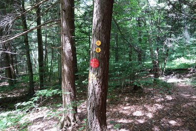
LT Relocated
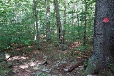
Angel Falls Red Marker
There is no clearly marked trail down to the foot of the falls. At this point I had to go off trail although I did see some old trail signs, a blue circle with an X mark in the center. This appears to be an old trail that is no longer maintained. I scrambled down the hill to find a boulder strewn area besides the falls where there is a rope swing. I also went further down the creek, Falls Run, to see another waterfall, possibly Gipson Falls.
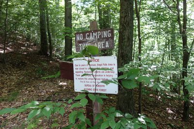
No Camping This Area
Angel Falls
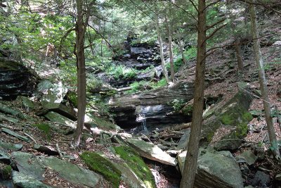
Gipson Falls
You definitely need hiking poles for this hike because there are many steep parts of the trail and climbing around the waterfalls is very difficult. You will also need waterproof hiking boots because I had to cross a few streams and parts of the trail were muddy and covered in water. I thought the hike was a bit of an ordeal and the Angel Falls isn’t a very safe place due to the lack of a good trail along the falls. I don’t recommend this hike unless you are feeling adventurous. On the other hand, this is a great hike if you want to go deep into the woods to see something pretty amazing.

